The Long Mynd
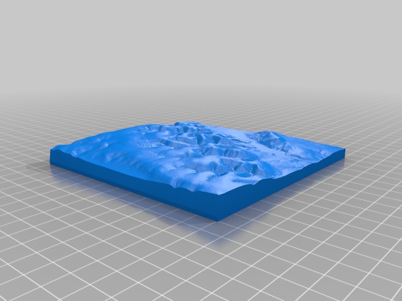
Created from Ordnance Survey open data (Terrain 50).
Scaled model of The Long Myn and surrounding area (including Church Stretton, Carding Mill Valley, Ashes Hollow Valley, Townbrook, Caer Caradoc) in The South Shropshire Hills AONB (1:50,000 Scale)
Created for use in Geography classroom and fieldwork with the Field Studies Council.
Designed to cover grid squares SO 4090 (south western corner) to SO 4595 (north eastern corner) at 1:50,000 Scale